 OpenAI - ChatGPT, Sora
 Google - Gemini, Nano Banana
 Anthropic - Claude
 xAI - Grok
 Deepseek
 Alibaba - Qwen
 ByteDance - Doubao
 All Models
 Enterprise Plans
 AI Application Development
 AI Translator API
 AI SEO/GEO Service
 GEO-Optimized PR Service
 Web Scraping Service
 OpenClaw
 Top AI Tools
 Top AI Robots
 Log in

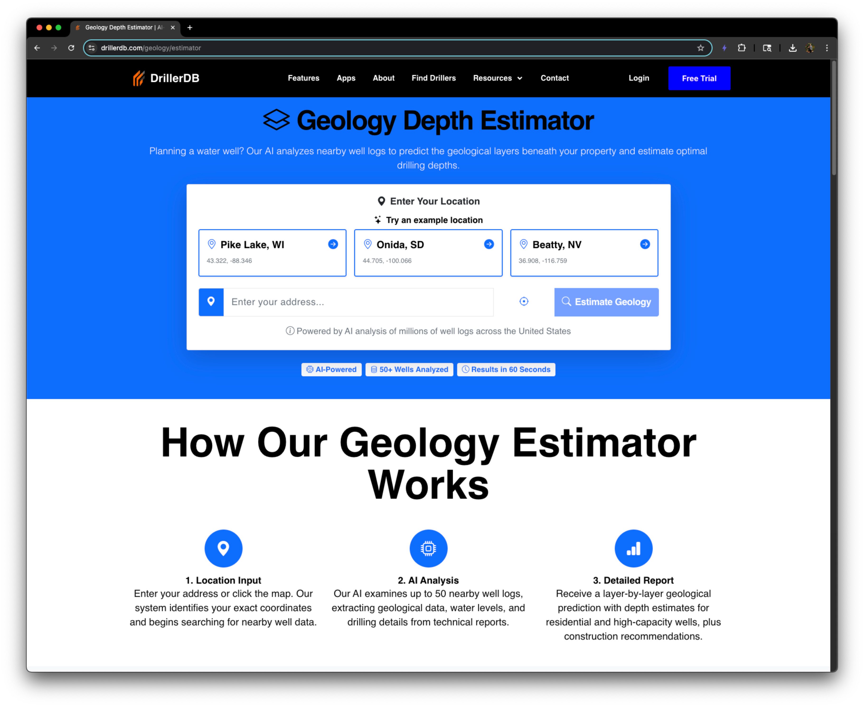

What is Geology Estimator – DrillerDB?
The Geology Estimator draws from DrillerDB's platform of public well records, standardized and enriched from state and federal sources to model conditions from shallow unconsolidated aquifers to deeper bedrock targets. Users can search an address and within seconds see a full geological analysis of their location. If enough data is not available at the location, the system will fall back to a simple depth estimate. This nationwide coverage pairs naturally with DrillerDB's Interactive Well Map, giving drillers and homeowners a single place to explore well history, context, and predictions.
Use Cases And Features
1. Estimate how deep water is at your home.
Understanding the depth to groundwater is critical for homeowners planning to install a new well or maintain an existing one. The Geology Estimator provides instant insights into subsurface water levels based on comprehensive regional data. This feature helps homeowners make informed decisions about well installation costs, expected drilling depths, and potential water availability. Whether you're in an area with shallow water tables or deeper bedrock aquifers, the estimator delivers reliable depth predictions tailored to your specific location.
2. Plan a well drilling operation at a location.
Professional drillers and contractors need accurate geological information to plan efficient drilling operations. The Geology Estimator eliminates guesswork by providing detailed subsurface analysis before equipment arrives on site. Users can evaluate geological formations, anticipated drilling challenges, and optimal well construction methods. This predictive intelligence helps drilling companies prepare appropriate equipment, estimate job duration, and provide accurate quotes to clients. The tool reduces operational risks and improves project planning across diverse geological settings nationwide.
3. Price out the cost of a new irrigation well.
Agricultural operations and landscape managers require cost-effective irrigation solutions. The Geology Estimator enables users to quickly assess the feasibility and approximate costs of installing irrigation wells. By predicting drilling depth requirements and geological conditions, the tool helps estimate material needs, labor hours, and total project expenses. This information is invaluable for budgeting irrigation projects, comparing different property locations, and making strategic decisions about water resource development for farms, golf courses, commercial landscapes, and residential properties.